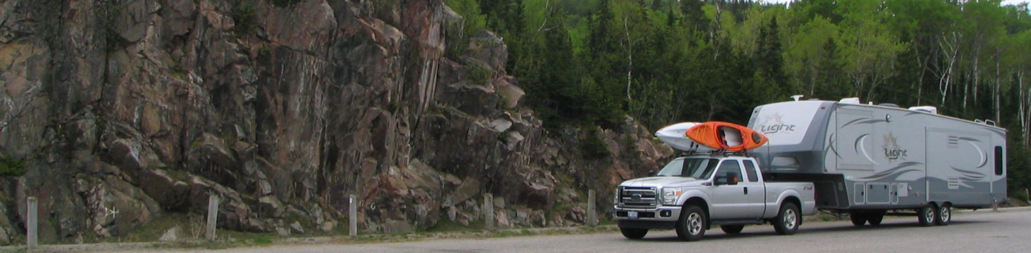
From Denali we drove north to Fairbanks, the furthest north we have ever been; ever by air, water, or land. I’d say it was cool but it wasn’t. The closer to Fairbanks we got the warmer it got. By the time we stopped in Fairbanks it was 23C. We left Denali it was 11C. On this highway, from Anchorage to Fairbanks, we way we passed towns on the map that were not much more than dilapidated building collections to decent looking small towns. Some ‘houses’ were more of a question mark, occupied?, can you get more stuff on the property?, is there a building code here?, how far do you have to go for groceries?? The day was overcast so photos were not plentiful. We have a lot of photos so far. My 32GB stick has 28.7 GB used up. The landscape changed from the usual tree lined highway to mountainous, river valley, tundra like, to rolling hill.
 We stayed 3 nights in Fairbanks. One of the days we took in a gold mine tour which gave us info on the Alaskan oil pipeline, a small gauge train ride to the mine, a museum and large gift store area at the Dredge, plus some gold panning. Between the two of us we panned out $24 worth of gold ‘dust’ – 24 US!. Tiny pieces really – no nuggets, but we talked about skipping our train and taking the next train back to the parking lot.
 We also booked a ride on one of the few remaining stern paddle wheeler boats left. I think Alaska only has two. They have a large gift shop building that came in handy to spend some time before the several 100 of us bordered. In one corner was a large freezer where tourists lined up in front of a freezer to experience what 40 below is like. Humans are a weird bunch. The boat cruise was a good informative and fun day, part of which was spent on the lands of the First Nations. Here a recreation of a village was built to show the way of life before the white man descended upon them, only about 100 years ago.
 After this we drove to the town of North Pole, Alaska. It’s an actual incorporated town with stores, businesses, and residential area, population about 2300, not some tiny purpose built tourist village. However, the street light poles are giant candy canes, most stores have a Santa related name as do many streets, and there’s Santa’s house! http://www.santaclaushouse.com. I expected better craftsmanship.
We went in, bought a trinket and had pictures of us taken with Santa who gave me some rather pointed instructions regarding someone’s wish(es). It has a rather large selection of Christmas ornaments as expected, plus a good selection of letters Santa has written pertaining to all sorts of wishes and children – good and no so good.
Fairbanks was a more relaxed city, much smaller than Anchorage, and had more to do. Leaving Fairbanks we drove south towards the town of Tok where we spent the night before driving to Dawson, Yukon Territory across the famed Top of The World Highway. Getting to Tok was a long drive with few chances to see the countryside due to the forest lined highway. The weather was nice; warm and clear. The cloudy conditions that stuck with us the previous week blew away and we were able to see the snow capped mountains. Quite impressive. Tok, not so much. It has gas, groceries, and a liquor store, where regardless of your age and appearance, State law says everyone must show government I.D. to buy booze. Why, store keepers couldn’t remember; no one is offended if all all asked? Get mugged can’t even drown your sorrows.
 In the morning we headed off for a drive that the GPA said would take less than 4 hrs. Anyone we spoke to said plan on 7. We drove Hwy 5 (Taylor Highway) north east towards the border crossing. I think they like Hwy 5 as much as they like their 2 dollar bill. Steep hills to mountains, trees, short scrub brush areas, large expanse of burnt forest, and brutal roads. Narrow, sand, gravel, broken pavement, and dust. Closer we got to the border the worse it got. Not fun meeting an oncoming truck. We did see a few RV’s coming at us which gave us hope; “If they made it”. Never considered that they may have turned back – out loud.
We stopped off in the town of Chicken for gas. Climbing mountains at 20 km/h burns fuel. It was advertised as worth a stop for the day. They didn’t say you had to stop cause the bridge was out and repairs are slow. We bought gas from a well stocked Chicken general store that had some decent crafts in it and crawled back out onto the cow path and made our way over the temp bridge and up a winding road that could have been a glacier creek bed at one time. Chicken, by the way, got its name from the bird that populates the area; the Ptarmigan. Apparently the people here wanted to name it Ptarmigan, nobody could agree on the spelling, nobody could agree on another name, so Chicken was chosen cause everyone could spell it. This year’s population is 7. The hwy also leads to the town of Eagle, but the highway is not cleared of snow past Chicken so they are on their own each winter. We took a picture of their sign and off we went.
Finally we got off the Hwy and onto Boundary Road (Hwy 9) which takes you to the border. This road was wide, smooth, brand new pavement all the way to the crossing. I  was going to slow down to savour it but that meant stopping on a hill. Great views of the mountains and steep valleys that start at the pavement edge. The road climbed up onto the top of mountain ridges and curled around the sides of mountains. You could see for miles.
Up we climbed to the crossing at a place called Little Gold Creek (Canada), Poker Creek (USA), elevation 4128 feet/ 1258 metres. They share the same Border crossing building but also have a separate building on each side of the border. The short chat with the Canadian border officer and we were ‘home’. We asked if there was a place to pull off so we could have lunch. The trip, so far, took about 5 hours to drive 191 kms, including the one hour time change back. She told us at the top of the next hill there was a pull out, “It’s where the Caribou hang out”. Sure enough we pull in and on the hill beside us are Caribou. 10 days in Alaska – nothing. 10 minutes in Canada ~ 100 Caribou.
 We sat eating lunch, watching the Caribou, other traffic off in the distance slowly drive the hills towards the US wondering how bad is the road where they are, and just staring off forever. Off we went on a gravel road that was in pretty good condition. The slow down we saw was due to another herd of Caribou grazing on a hill beside the road. Hill! We ate lunch at 4318 feet, climbed higher, and looked up at the Caribou.
The Canadian side of the Top of The World Highway is 67 miles / 110 kms long. The views for the first half are great. No guard rails, amazingly steep cliffs to valleys, and clear skies. The last half was a return to a forest sided highway but the cliff edges were there on  most turns. Coming to the end of the highway is a long steep hill that twists and turns down 2000 feet/ 600 metres to the ferry to Dawson, Yukon Territory. We stopped in line behind other RVs and vehicles and let our truck and trailer join in on the cracks and pings of the engines and brakes cool while the odour of hot brake pads permeated the breeze. The hill ended at the river bank.
The river was the fastest I’ve seen for something this wide. After a few ferry trips it was our turn to drive on and after several back up, go forward, this way that way, and me saying I can take the next one – we’re on vacation we were on far enough to draw up the tailgate. They were trying to get two large RVs on the ferry. Nice guys running the ferry, had a chat with them, and they appropriately blamed the guy beside us for his poor parking. The ferry is free, paid for by Territory of Yukon. Almost 8 hours after leaving Tok we were in Dawson and what a neat looking sight it was, but it would wait until tomorrow. We (and the trailer) were beat and hungry.