 Lake Louise and the Glacial Plain Trail was the plan for day 2 at Lake Louise campground. We got up at 6 am loaded the truck with our gear and lunch we readied the night before and were on our way. It was a crisp clear morning with the temp showing 3C. The drive up to the lake is steep but fairly short in time getting there. We arrived in the parking lot at 6:40 am and found we sleep in compared to many others. Luckily there was parking for us and more importantly only two other canoes on the lake. By the time we had carried our kayaks to our launch site the lake was clear. Turned out it was a photo-op for a wedding party. The group was dressed in dressy-casual summer wear; dress shorts, sandals, and collared, short sleeve shirts – in 3 degree weather.
 We launched the kayaks and paddled the shoreline around the lake taking dozens and dozens of photos with our Garmin Virb Ultra 30 camera while hikers along the shore took photos of us. One excited tourist took photos of us while we suited up and launched the kayaks and had his wife take a photo with him kneeling beside the kayak. Lake Louise is a beautiful spot surrounded by mountains with the Chateau anchoring one end and a picturesque view of a glacier at the other. The water has a teal/turquoise colour, is very cold, and this morning, varying between light chop to glass smooth and back again. It was an amazing feeling to be on this lake by ourselves surrounded by the mountains and the quiet. Molson came along with us and took up his reserved spot on the rear deck of Jennifer’s kayak. He hates getting wet but seems to like the kayak.
Two hours later we had strapped the kayaks back on our truck and took to the trail. We passed the excited tourist who called out to us and with more hand signals and gestures we figured out he wanted selfie photos with us. I took a photo of Jennifer and him and off he happily went, leaving me hanging there. We started with the intent of hiking up to Lake XXX and the Tea House. A few trails started off together and split off at different spots along the way. One thing we noticed is that the Canada National Parks do not sign their trails as well as Ontario Parks do. The trails here are in good shape and easy to see, it’s just there is little signage. We missed the cut off for the Tea House and kept going towards the Glacier Plain which would give us an up close look at the glaciers and their mountains.
Today is June 21st, first day of summer and it started off at 3 degrees C and there is snow along the trail. At least 9 areas of the trail were covered with snow, trees, branches, and rock from this year’s avalanches. It seemed each one we had to cross was larger or steeper than the previous. One required a hike of about 100 metres up and along it. As we got higher the weather changed from cool to colder to cold, windy and snow; thick enough that it blurred the sight of the mountains across the valley. 
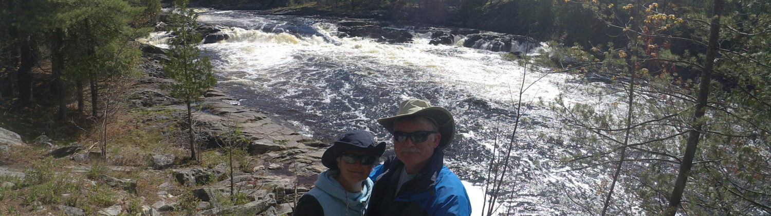
We stopped for a lunch and water break then continued on the trail and the next avalanche remains. As we were climbing up and over number 9? we came to the conclusion that we were nuts. Both of us were dressed warm enough and had hiking boots on but it was windy, cold, and my summer treads were not giving me enough grip. Our GPS showed we had covered over 4 km and climbed 585 metres (1900+ feet) to a height of 2076 metres (6811 feet). Looking back over the trail we had an awesome view of Lake Louise and the Chateau. Looking forward we could see the trail continue upwards and around out of sight. Breathing at 6811 feet while walking up hill is quite different than walking along the road near pancake flat Windsor, Ontario. So we decided we saw enough for today and turned back. Going back down we travelled into warmer and summer conditions that made the snow trail mushy and slippery. Jennifer took a spill down the remains of one avalanche and tobogganed down the final 10 metres. Looking over to my right I saw if she fell right instead of straight ahead the slide would have been about 300 metres longer, and down, but the walk along the river at the bottom would have been flat and easy. She wanted no part of it, or the humour in it.
 Going back down gave us great views of the lake and the mountains but from a different angle. We saw the turn off we missed to go up to the Tea House. I don’t like tea that much and the climb is steeper. We also saw the vast differences in clothing and apparel worn by people hiking the trail. From coats, hats, boots, packs and hiking poles to shorts and T-shirts. We passed one nut-bar, where it was snowing, wearing shorts and open sandals. He was 20-something so he wasn’t wearing socks at least.